Alum Rock County Park
Hike Date: 11/20/11

 Today I decided to hike in Alum Rock Park in northeast San Jose. I reached there by taking Route 680, Berryessa road exit followed by Penitencia Creek road. There is a free parking at the trailhead with approximately 25 cars capacity. Alum Rock Park is a historical park, being the first municipal park in state of California. The park entrance has a big rock at the entrance (largest meteor in the World?) weighing 2000 tons known as Alum Rock Meteor. The park had a train service going between Penitencia Creek and Alum Rock Avenue from 1896 till 1934.

I started on Penitencia Creek trail from the main entrance. It starts behind the restrooms near the entrance. It was a cloudy day with temperatures in 50s. At the entrance there are lots nice flowers almost reminding of spring season but it is only a fall right now. The trailhead is at 253 feet elevation. After walking few hundred meters you meet a fork where I took a left and crossed the creek through feet deep water and merged on to North Rim Trail. This trail goes below Eagle Rock and meets Todd Quick trail where the trail starts ascending. I spotted couple of deer on this trail. After another half a mile I took another left at he fork to Boccardo Loop Trail. One patch of this trail is very steep and loops around the peak.
 The peak is at 1965 feet elevation. You get fabulous 360 degrees view at the top. It was extremely cold and windy at the top. Luckily I had good gear with me protecting myself. There is recently opened new trail for Sierra Vista near the peak and I was tempted to go on it. Round trip to the Sierra Vista peak would have been additional 11 miles. But it had started raining hard so I decided to hike it some other time.

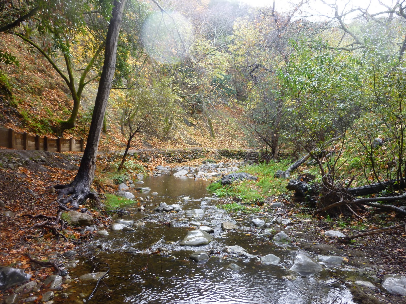
I continued on the Boccardo loop and merged back on the North Rim Trail towards the Youth Science Institute. This part of the trail descends very quickly towards 500 feet elevation. I crossed the bridge on the Upper Penitencia Creek. Here you see beautiful fall colors. The south part of creek has dense trees compared to open hills
on the North rim. I started my return journey on Woodland trail, which goes along the beautiful creek. I again saw 2 deer on the way back.

Rain had stopped by now. I took few good snaps in the creek water. Near the crossing bridge there are beautiful picnic spots. On the south rim there are many short trails you can visit. I finished my hike in around 4 hours with 7.35 miles and around approximately 2000 feet elevation change.


 Today I decided to hike in Alum Rock Park in northeast San Jose. I reached there by taking Route 680, Berryessa road exit followed by Penitencia Creek road. There is a free parking at the trailhead with approximately 25 cars capacity. Alum Rock Park is a historical park, being the first municipal park in state of California. The park entrance has a big rock at the entrance (largest meteor in the World?) weighing 2000 tons known as Alum Rock Meteor. The park had a train service going between Penitencia Creek and Alum Rock Avenue from 1896 till 1934.
I started on Penitencia Creek trail from the main entrance. It starts behind the restrooms near the entrance. It was a cloudy day with temperatures in 50s. At the entrance there are lots nice flowers almost reminding of spring season but it is only a fall right now. The trailhead is at 253 feet elevation. After walking few hundred meters you meet a fork where I took a left and crossed the creek through feet deep water and merged on to North Rim Trail. This trail goes below Eagle Rock and meets Todd Quick trail where the trail starts ascending. I spotted couple of deer on this trail. After another half a mile I took another left at he fork to Boccardo Loop Trail. One patch of this trail is very steep and loops around the peak.
 The peak is at 1965 feet elevation. You get fabulous 360 degrees view at the top. It was extremely cold and windy at the top. Luckily I had good gear with me protecting myself. There is recently opened new trail for Sierra Vista near the peak and I was tempted to go on it. Round trip to the Sierra Vista peak would have been additional 11 miles. But it had started raining hard so I decided to hike it some other time.
I continued on the Boccardo loop and merged back on the North Rim Trail towards the Youth Science Institute. This part of the trail descends very quickly towards 500 feet elevation. I crossed the bridge on the Upper Penitencia Creek. Here you see beautiful fall colors. The south part of creek has dense trees compared to open hills
on the North rim. I started my return journey on Woodland trail, which goes along the beautiful creek. I again saw 2 deer on the way back.
Rain had stopped by now. I took few good snaps in the creek water. Near the crossing bridge there are beautiful picnic spots. On the south rim there are many short trails you can visit. I finished my hike in around 4 hours with 7.35 miles and around approximately 2000 feet elevation change.


Comments
Post a Comment